Shapefile, KML, GeoJSON, CorelDraw
Download categories
Downloads
Transmission lines of Sao Paulo
* Type: Shapefile * Group: Energy * Title: Transmission lines of Sao Paulo * Description: Map of transmission lines of Sao Paulo state in shapefile format (SHP) * Metadata: =================================== GISMAPS - www.gismaps.com.br =================================== Mapas Temáticos - Geoprocessamento =================================== * Grupo:…
Electricity power plants (SHP)
* Type: Shapefile * Group: Energy * Title: Electricity power plants (SHP) * Description: Map of power plants of the Brazilian National Interconnected System in Shapefile format (SHP) * Metadata: =================================== GISMAPS - www.gismaps.com.br =================================== Mapas Temáticos…
Refineries in Brazil- SHP
* Type: Shapefile * Group: Energy * Title: Refineries in Brazil- SHP * Description: Geographical location of Petrobras refineries and other private refineries, including the polygon of the industrial area, organized in shapefile (SHP) * Metadata: ===================================…
Pre-Salt
* Type: Shapefile * Group: Energy * Title: Pre-Salt * Description: Polygon of Pre-Salt * Metadata: =================================== GISMAPS - www.gismaps.com.br =================================== Mapas Temáticos - Geoprocessamento =================================== * Grupo: Energia * Título: Pré-Sal * Descrição: Polígono do Pré-Sal…
Libra oil field
* Type: Shapefile * Group: Energy * Title: Libra oil field * Description: Polygon of Libra oil field * Metadata: =================================== GISMAPS - www.gismaps.com.br =================================== Mapas Temáticos - Geoprocessamento =================================== * Grupo: Energia * Título: Campo de…
Sectors of oil exploration and production
* Type: Shapefile * Group: Energy * Title: Sectors of oil exploration and production * Description: Map of sea and land sectors of oil exploration and production, including the name of the sedimentary basin * Metadata: ===================================…
Oil wells – public
* Type: Shapefile * Group: Energy * Title: Oil wells – public * Description: Map of exploration, development and production oil wells - public, including operating company, sedimentary basin and depth * Metadata: =================================== GISMAPS - www.gismaps.com.br…
Oil wells – confidential
* Type: Shapefile * Group: Energy * Title: Oil wells - confidential * Description: Map of exploration, development and production oil wells - confidential, including operating company and sedimentary basin * Metadata: =================================== GISMAPS - www.gismaps.com.br ===================================…
Oil production fields
* Type: Shapefile * Group: Energy * Title: Oil production fields * Description: Map of oil production fields, including company, contract start date, fluid and bid * Metadata: =================================== GISMAPS - www.gismaps.com.br =================================== Mapas Temáticos - Geoprocessamento…
Free downloads
West-East Railroad (KML)
* Type: KML * Group: Transport * Title: West-East Railroad (KML) * Description: KML file of West-East Railroad (FIOL), under construction, including points of interests * Metadata: =================================== GISMAPS - www.gismaps.com.br =================================== Mapas Temáticos - Geoprocessamento =================================== * Grupo: Transporte * Título:…
Transnordestina Railroad (KML)
* Type: KML * Group: Transport * Title: Transnordestina Railroad (KML) * Description: Kml file of Transnordestina Railroad (underconstruction), including crossings, reverse loops and fright origins * Metadata: =================================== GISMAPS - www.gismaps.com.br =================================== Mapas Temáticos - Geoprocessamento =================================== * Grupo: Transporte…
Meatpacking companies im Mato Grosso (SHP)
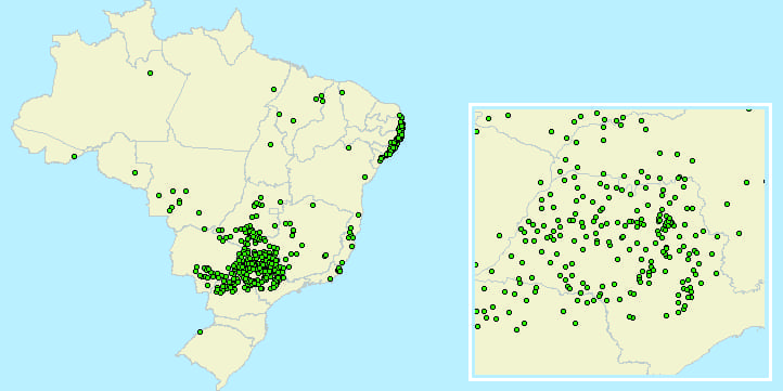
* Type: Shapefile * Group: Agriculture * Title: Meatpacking companies im Mato Grosso (SHP) * Description: Location of meatpacking companies in Mato Grosso in shapefile (SHP) * Metadata: =================================== GISMAPS - www.gismaps.com.br =================================== Mapas Temáticos -…
Meatpacking companies im Mato Grosso (KML)
* Type: KML * Group: Agriculture * Title: Meatpacking companies im Mato Grosso (KML) * Description: Location of meatpacking companies in Mato Grosso in KML file * Metadata: =================================== GISMAPS - www.gismaps.com.br =================================== Mapas Temáticos - Geoprocessamento ===================================…
Amazon geoglyphs (KML)
* Type: KML * Group: History * Title: Amazon geoglyphs (KML) * Description: Geoglyphs in the Amazon region registered and organized by James Q. Jacobs * Metadata: =================================== GISMAPS - www.gismaps.com.br =================================== Mapas Temáticos - Geoprocessamento…
Pre-Salt
* Type: Shapefile * Group: Energy * Title: Pre-Salt * Description: Polygon of Pre-Salt * Metadata: =================================== GISMAPS - www.gismaps.com.br =================================== Mapas Temáticos - Geoprocessamento =================================== * Grupo: Energia * Título: Pré-Sal * Descrição: Polígono do Pré-Sal…
Libra oil field
* Type: Shapefile * Group: Energy * Title: Libra oil field * Description: Polygon of Libra oil field * Metadata: =================================== GISMAPS - www.gismaps.com.br =================================== Mapas Temáticos - Geoprocessamento =================================== * Grupo: Energia * Título: Campo de…
Consumption Potential Index (IPC)
* Type: Shapefile * Group: Marketing * Title: Consumption Potential Index (IPC) * Description: Cooking oil Consumption Potential Index (IPC) organized by Federal Units, meso, micro, municipalities and cities * Metadata: =================================== GISMAPS - www.gismaps.com.br =================================== Mapas…
Acre municipalities boundaries
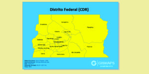
* Type: CDR * Group: Political boundary * Title: Acre municipalities boundaries * Description: Maps in Corel Draw format with the polygons of Acre municipalities * Metadata: =================================== GISMAPS - www.gismaps.com.br =================================== Mapas Temáticos -…
Make your own maps.
![]()
Gismaps Viewer – Corp
Gismaps Viewer is a GIS software to generate thematic maps and view satellite images. It can be used for: Produce printed maps of high quality; Conduct market analysis; Make spatial queries; Sales regions maps; Distribute maps…
Gismaps Viewer
Gismaps Viewer is a GIS software to generate thematic maps and view satellite images. It can be used for: Produce printed maps of high quality; Conduct market analysis; Make spatial queries; Sales regions maps; Distribute maps…

Serviço aos Clientes
Produção de Mapas
» diversos tamanhos e aplicações
Cursos
» Gismaps Viewer, Quantum GIS, ArcGis e Google Earth
Clientes
» empresas que já conhecem a Gismaps Sistemas
Índice de Potencial de Consumo
» IPCs para planejamento nas áreas de Marketing e vendas
Softwares
Gismaps Viewer
» licença para uso individual
Gismaps Viewer Corp
» licença para uso corporativo
Tutoriais
» documentos de referência do Gismaps Viewer
Ajuda
Como Comprar
» instruções para comprar e solicitar propostas
E-mail:
vitor@gismaps.com.br
Telefone:
+55 (19) 99608-6269
![]()
![]()
![]()
![]()

